For over a century, people have used photogrammetry in cartography and aerial surveillance.
Today, we use it to produce 3D datasets of buildings, places, and objects in our historic environment, as part of the Rae Project.
History of photogrammetry
French Inventor Aimé Laussedat developed photogrammetry as a concept in 1851.
Early photogrammetry took advantage of advances in photography. Images could be taken from different angles and locations, and combined with angular and distance measurements to accurately place points in the landscape.
It began to be adopted more widely in the early twentieth century with the introduction of terrestrial photogrammetry, and First World War aerial photogrammetry.
Modern photogrammetry relies on similar principles but uses computer vision algorithms to align the digital photographs and create 3D data points from them. This is called ‘Structure from Motion’ (SfM) photogrammetry.
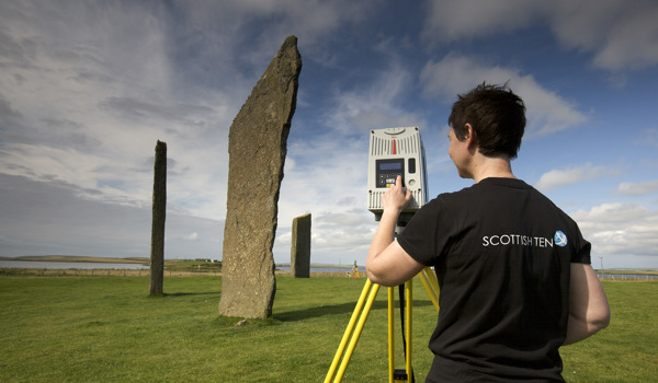
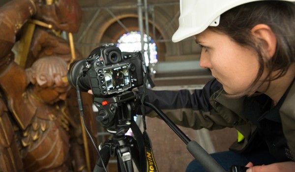
We use this in digital documentation to record historical subjects, from small artefacts, to buildings and landscapes.
How photogrammetry works
Digital photographs are put through different algorithms. These algorithms calculate the camera positions from the photographs and combine them into one 3D space. This process is called an alignment.
Once the photographs have been aligned, high resolution 3D data is generated and used to produce detailed 3D “surface geometry”. This is a digital representation of the features of the building or object photographed.
This data can be represented as a collection of high-resolution 3D coordinates (a “point cloud”), or connected 3D surfaces as a 3D model.
Sometimes we use drones as part of this process. They help us to access hard-to-reach areas of our sites and gain new perspectives of them.
We add laser scans, high resolution texture maps (complete with fine details, surface textures, and colours), and terrestrial and aerial data to build a more complete representation of the sites.
To use the 3D data for measurements, photogrammetry needs a scale. We have to input a known distance between two points to provide this scale reference.
From there, the software can calculate the rest and transform the 3D data to the correct scale. Most photogrammetry software packages include support to accurately scale the 3D data.
Quality and processing
Missing or limited photography can impact the accuracy and quality of the data. This will result in “holes” and missing sections of data.
Other factors which might affect the quality of 3D data and how long it takes to process include:
- complex subjects
- materials including repeating patterns, smooth and featureless surfaces, and refractive and highly reflective materials like metals, glass, polished ceramics, minerals, and plastics
- photography environment, i.e. lighting conditions and exposure
- software operator knowledge and technique
- photography knowledge and technique
- camera systems, including sensor resolution and lens quality
- available software
- specifications of processing hardware
Consider these factors when planning any photogrammetry projects.
The benefits of photogrammetry
The benefits of completing photogrammetry to a high standard throughout the process are:
- high accuracy, high resolution 3D data at different scales
- high quality images to create texture maps
- access to challenging areas during surveys, with mobile camera systems
- low cost relative to other 3D capture techniques